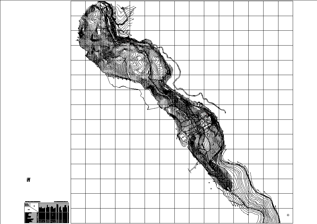
Plan showing the contour lines of the area; acomayo and pachachupan; it could be used as a reference for the development of construction projects for the area; the urban distribution of the population centers of acomayo and pachachupan is also noted.

.")