
San juan de lurigancho, lima dwg
.")
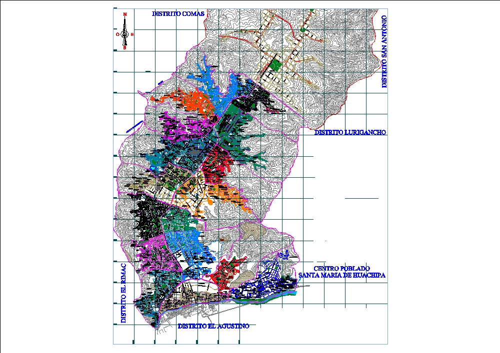
Description of the map of san juan de lurigancho. location: san juan de lurigancho (sjl) is a district located in the northeast of the province of lima, peru. it borders: north: with the district of carabayllo. south: with el agustino and ate. east: with san antonio (province of huarochirí). west: with el rímac and san martín de porres. territorial area: approximately 131.25 km²; it is the most populated district in peru and one of the largest in metropolitan lima. average altitude: between 150 and 400 meters above sea level; with variations depending on the area. main access roads: av. próceres de la independencia; central axis of the district; av. canto grande; av. wiesse; av. las flores de primavera. line 1 of the lima metro runs through a large part of the district, connecting with the city center.