Cartography of the municipality of manizales in colombia; contains main contour lines every 10 meters and secondary contour lines every 2 m. it also has a projected road with its horizontal alignment; vertical and cants.
Confirma el mail en Facebook e intenta nuevamente.
Confirma el mail en Google e intenta nuevamente.
Your account is inactive. To request a reactivation you can contact us by email atsoporte@bibliocad.com.
 Deutsche
 English
 Español
 Français
 Portugues
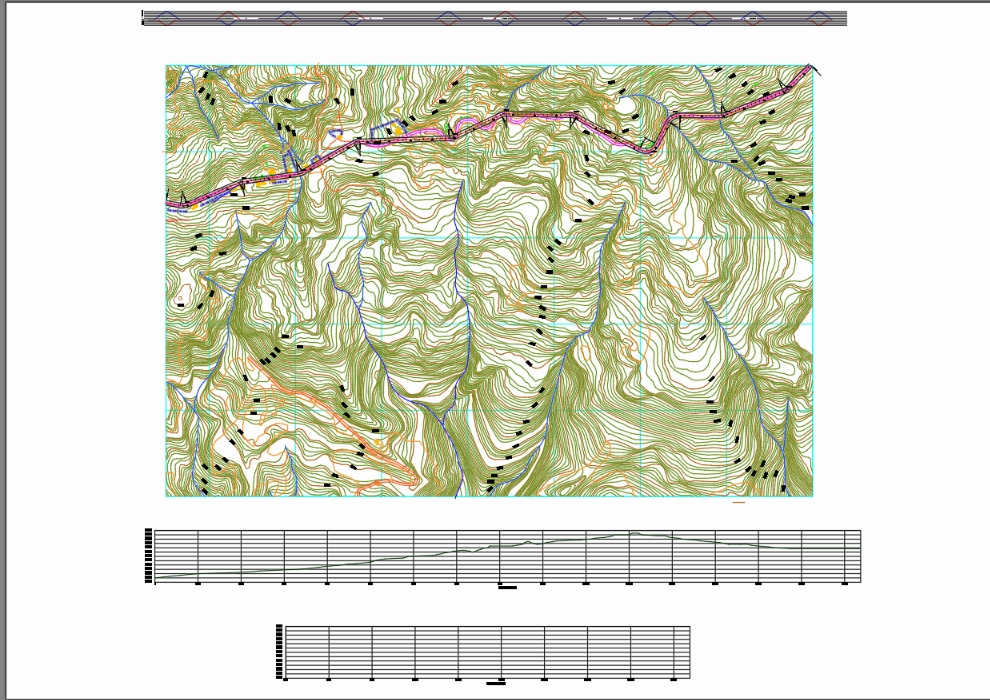
.")


